The global leader in GPS navigation, Garmin has introduced its new Custom Maps that allows the users to transform and convert their existing paper or digital maps into downloadable maps to their Garmin navigator device. Garmin Custom Maps is being created by using Garmin map drawing technology for georeferencing map images and effectively downloading printed or digital maps.
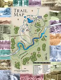
“Free Custom Maps can be used by anyone wanting to bring their favorite locations to life,” said by Dan Bartel, Garmin’s vice president of worldwide sales. “Potential users include new students on college campuses, experienced hunters on game areas, and the millions of visitors to zoos, amusement parks and botanical gardens.”
Several steps to transform existing maps to Custom Maps:
- Save existing map in JPG format by scanning a paper map or converting into a digital file.
- Georeference the new map image by using Google Earth to line up key landmarks with those depicted on the map.
- Save Custom Maps to the Garmin device and get ready to go for explore
The Custom Maps is available as a free download with the latest Garmin software at http://my.garmin.com. This Custom Maps has been tested to compatible with Dakota, Oregon and Colorado outdoor GPS handhelds. Furthermore, this service is also available for use in PCs and Macs.
 Tip and Trick
- How To Download HBO Shows On iPhone, iPad Through Apple TV App
- Windows 10 Insider Preview Build 19025 (20H1) for PC Official Available for Insiders in Fast Ring – Here’s What’s News, Fixes, and Enhancement Changelog
- Kaspersky Total Security 2020 Free Download With License Serial Key
- Steganos Privacy Suite 19 Free Download With Genuine License Key
- Zemana AntiMalware Premium Free Download For Limited Time